Marking your "Paper" on the Ground and your Ground on Paper since 1935

Klettke Surveyors
Call Us At: 716-731-5613
KLETTKESUR@AOL.COM
2470 Stoelting Street
Niagara Falls (Wheatfield) N.Y.
14304
Property Surveys
Klettke Surveying Services
NFLSA Code Surveys
Topographic Mapping
Property Survey Maps benefit many parties (owner, buyer, attorneys, banks, title insurance companies) involved with the warrant of free and clear title in any real estate transaction or mortgage closing. They also are the basis of any planned improvement to the property and are usually required to obtain a municipal building permit. In the event of a boundary dispute, a properly prepared survey map will usually be the basis of its resolution.
At Klettke Surveyors, we take care to provide to our customers high quality services personalized for their unique needs. Please use the Request Box or feel free to call our office at 716-731-5613,
Mon. - Fri. 8am - 6pm
and most Saturdays between 10am - 1pm.
Ask for either Neal or Matthew.
We provide a variety of services including:
With Klettke Land Surveyors, a New York State licensed surveyor will perform all the tasks involved in preparing a survey map in accordance with the Code of Practice for Land Surveyors adopted by the Niagara Frontier Land Surveyors Association (NFLSA). These tasks include public record and survey file research, field investigation and measurement of the parcel boundary markers (and those of relevant nearby parcels), boundary evidence analysis, placement of boundary corner markers and final preparation of the survey map.
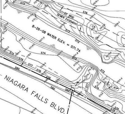
This effort enlists the surveyor in support of the design team planning any site improvements. Topographic maps digitally model and graphically represent existing physical features of the land, both natural and manmade. For example ground contours, structures, paved surfaces, fences, utilities, bodies of water, etc. may be mapped. Klettke Surveyors have been performing topographic surveys for Design Professionals, Land Developers, homeowners, and industrial clients throughout our history. Please contact us for a proposal based on your unique scope of work.
Other Services
Subdivision Mapping, Easement Mapping, Suggested Deed Descriptions, Wetland Mapping, Stockpile and Excavation Volume Surveys, Site Modeling for Machine Control, Accident Mapping
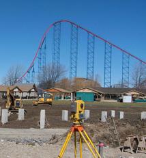
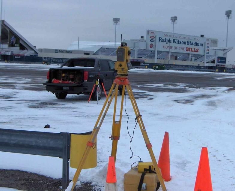
Construction Staking
Construction staking is done for the layout and control of new improvements based on plans prepared by design professionals. Surveyors stake locations on the ground as requested by the contractor or developer, to ensure that the improvements are built in the location specified on design plans. Construction staking provides the horizontal location and can include the vertical location of buildings, roads, storm and sanitary sewer lines, water lines, site grading, walls, parking areas, etc. We make every effort to meet the tight schedules that typify construction projects.
ALTA/ACSM LAND TITLE SURVEYS
ALTA/ACSM (American Land Title Association / American Congress on Surveying and Mapping) Land Title Surveys are a more comprehensive type of survey (usually specified for certain commercial properties). When ordering an ALTA/ACSM survey, be sure to specify only the Table A Optional Requirements that are required by those involved in the real estate transaction. Click here for Table A form. (go to pg 8 of 10)
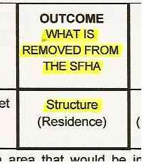
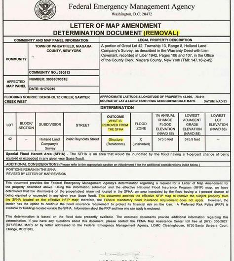
FEMA Flood Insurance Elevation Certificates, LOMA (Letter of Map Ammendment), LOMR (Letter of Map Revision).
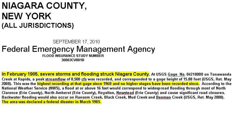
Are you looking to eliminate or reduce Flood Insurance costs? Federally-backed mortgages often impose the flood insurance requirement on properties appearing in flood zones on FEMA maps. You have several options to minimize or eliminate this financial burden. We have over 25 years experience with FEMA Elevation Certificates, Letters of Map Ammendment (LOMA) and Letters of Map Revision (LOMR). Please call or request a
FEMA Survey Work Order Fill-in Form in the “Request Information” box.
We have a vast inventory of records for Niagara County and portions of Erie County and Orleans County, dating back more than 80 years. See this website's "Quality of Work" section for more details on their use in properly locating property boundaries.
For a cost estimate on performing any type Real Property Survey, please call or request a Property Survey Work Order Fill-in Form in the “Request Information” box.
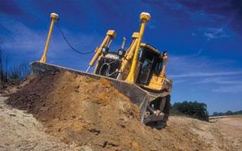
Site Modeling for Machine Control
In the Request box, please list: type of survey, at location
(ex. FEMA survey work order form,
2542 Nia. Falls Blvd., Wheatfield)
Construction Staking